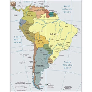
Home > North America > Honduras > Maps
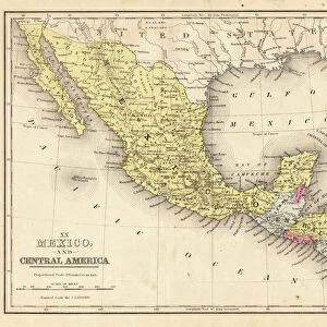
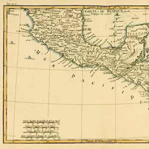
Antique map of Honduras Yucatan and Mexico 1671

![]()
Wall Art and Photo Gifts from Fine Art Storehouse
Antique map of Honduras Yucatan and Mexico 1671
Map of Honduras Yucatan and Mexico
Original edition from my own archives
Source: America New World Empires 1671
Unleash your creativity and transform your space into a visual masterpiece!
Grafissimo
Media ID 18356571
FEATURES IN THESE COLLECTIONS
> Fine Art Storehouse
> Map
> Historical Maps
> Maps and Charts
> Early Maps
> Maps and Charts
> World
> North America
> Honduras
> Maps
> North America
> Mexico
> Related Images
EDITORS COMMENTS
This print showcases an exquisite antique map of Honduras, Yucatan, and Mexico from the year 1671. A true gem from my personal archives, this original edition is a testament to the rich history and exploration of the New World Empires during that era. The intricate details and delicate craftsmanship of this map are truly awe-inspiring. As you gaze upon this piece, you can't help but be transported back in time to an age of discovery and adventure. Every line on the map tells a story - revealing ancient cities, uncharted territories, and vast expanses waiting to be explored. It's as if you can almost hear the whispers of explorers like Hernán Cortés or Francisco de Montejo planning their expeditions through these lands. The warm hues and aged texture add a sense of authenticity to this remarkable print. It serves as a reminder not only of our past but also of how far we have come in understanding our world today. Whether you're a history enthusiast or simply appreciate fine art, this piece will undoubtedly captivate your imagination. With its timeless appeal and historical significance, "Antique Map of Honduras Yucatan and Mexico 1671" by Grafissimo is more than just a decorative item; it's a window into another time – an invitation to explore the stories hidden within its carefully drawn borders.
MADE IN THE USA
Safe Shipping with 30 Day Money Back Guarantee
FREE PERSONALISATION*
We are proud to offer a range of customisation features including Personalised Captions, Color Filters and Picture Zoom Tools
SECURE PAYMENTS
We happily accept a wide range of payment options so you can pay for the things you need in the way that is most convenient for you
* Options may vary by product and licensing agreement. Zoomed Pictures can be adjusted in the Cart.