Home > North America > United States of America > Colorado > Fort Collins
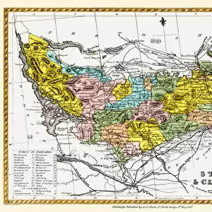
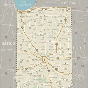
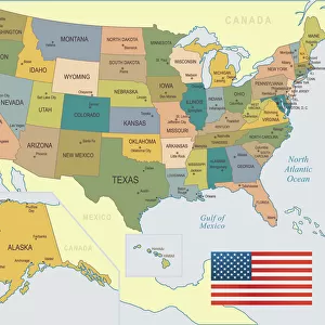
Fort Collins Colorado US City Street Map

![]()
Wall Art and Photo Gifts from Fine Art Storehouse
Fort Collins Colorado US City Street Map
Vector Illustration of a City Street Map of Fort Collins, Colorado, USA. Scale 1:60, 000.
All source data is in the public domain.
U.S. Geological Survey, US Topo
Used Layers:
USGS The National Map: National Hydrography Dataset (NHD)
USGS The National Map: National Transportation Dataset (NTD)
Unleash your creativity and transform your space into a visual masterpiece!
Frank Ramspott
Media ID 15215858
© Frank Ramspott, all rights reserved
Aerial View City Map Colorado Computer Graphic Directly Above Downtown District Gray Road Map Text Digitally Generated Image Fort Collins Green Color White Color
FEATURES IN THESE COLLECTIONS
> Aerial Photography
> Related Images
> Animals
> Insects
> Hemiptera
> Green Scale
> Arts
> Contemporary art
> Digital artwork
> Street art
> Arts
> Landscape paintings
> Waterfall and river artworks
> River artworks
> Arts
> Portraits
> Pop art gallery
> Street art portraits
> Arts
> Street art graffiti
> Digital art
> Digital paintings
> Arts
> Street art graffiti
> Digital art
> Vector illustrations
> Fine Art Storehouse
> Map
> Street Maps
> Fine Art Storehouse
> Map
> USA Maps
> Maps and Charts
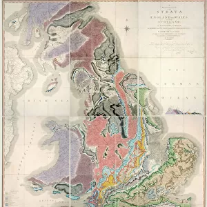
> Geological Map
> Maps and Charts
> Related Images
> North America
> United States of America
> Colorado
> Fort Collins
EDITORS COMMENTS
This print showcases a detailed and meticulously designed city street map of Fort Collins, Colorado, USA. With a scale of 1:60,000, every intricate detail is brought to life in this vector illustration. The source data used for creating this masterpiece is all from the public domain, specifically obtained from the U. S. Geological Survey's National Hydrography Dataset (NHD) and National Transportation Dataset (NTD), both available through USGS' The National Map. The artwork encompasses various elements that define the charm of Fort Collins - its downtown district, serene lakes and rivers, bustling streets, and overall city layout. Created using advanced cartography techniques and digitally generated imagery by talented artist Frank Ramspott, this visually stunning aerial view provides an unparalleled perspective directly above the city. With a color palette featuring shades of gray, blue, white, and green; this print effortlessly captures the physical geography of Fort Collins. It beautifully combines computer graphics with text to create an engaging visual representation that will surely captivate any viewer. Perfect for enthusiasts of maps or those with a special connection to Fort Collins' vibrant community spirit; this art piece offers not only aesthetic appeal but also serves as a functional road map for navigation purposes. Whether displayed at home or in an office setting, it adds sophistication while showcasing your love for cartography and design.
MADE IN THE USA
Safe Shipping with 30 Day Money Back Guarantee
FREE PERSONALISATION*
We are proud to offer a range of customisation features including Personalised Captions, Color Filters and Picture Zoom Tools
SECURE PAYMENTS
We happily accept a wide range of payment options so you can pay for the things you need in the way that is most convenient for you
* Options may vary by product and licensing agreement. Zoomed Pictures can be adjusted in the Cart.