Home > Europe > United Kingdom > England > London > Art > Theatre
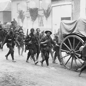
The Second Phase of the Great Retreat... 1914, (c1920). Creator: Unknown
. Creator: Unknown")
![]()
Wall Art and Photo Gifts from Heritage Images
The Second Phase of the Great Retreat... 1914, (c1920). Creator: Unknown
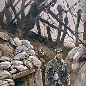
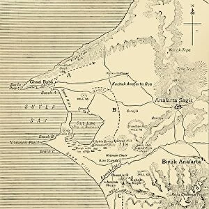
The Second Phase of the Great Retreat: Plan Showing the British Positions from August 28 to September 6, 1914, 1920. The map also indicates the positions of the Allies and of the German army under General von Kluck at the beginning of the Battle of the Marne. Map of northern France, showing battle lines during the First World War. From " The Great World War - A History" Volume I, edited by Frank A Mumby. [The Gresham Publishing Company Ltd, London, c1920]
Heritage Images features heritage image collections
Media ID 19174162
© The Print Collector/Heritage Images
Alexander Von Armies Frank Arthur Frank Arthur Mumby Front Line Frontline Gresham Publishing Co Ltd Gresham Publishing Company Keystone Archives Mumby Mumby Frank Arthur Position Retreat Territorial Territory The Great World War A History Theatre Of War Battlefield Kluck
FEATURES IN THESE COLLECTIONS
> Europe
> France
> Canton
> Allier
> Europe
> France
> Canton
> Marne
> Europe
> United Kingdom
> England
> London
> Art
> Theatre
> Historic
> Battles
> Related Images
> Historic
> World War I and II
> Battlefields
> Historic
> World War I and II
> Generals and leaders
> Historic
> World War I and II
EDITORS COMMENTS
The Second Phase of the Great Retreat. . . 1914, (c1920). This print takes us back to a pivotal moment in history - the First World War. Created by an unknown artist, it showcases a map titled 'The Second Phase of the Great Retreat: Plan Showing the British Positions from August 28 to September 6,1914'. The detailed map not only highlights the British positions during this critical period but also indicates the locations of both Allied forces and General von Kluck's German army at the onset of the Battle of Marne. With its vibrant colors and intricate details, this print offers a glimpse into one of humanity's most devastating conflicts. It serves as a reminder of the immense sacrifices made by armies on both sides as they fought for territorial control in northern France. The strategic importance of these battle lines is evident as we witness how various nations maneuvered their troops across this war-torn landscape. Originally featured in 'The Great World War - A History' Volume I edited by Frank A Mumby, this historical artifact transports us back to an era defined by conflict and resilience. As we examine each position marked on this map, we can't help but marvel at how such seemingly small dots represent countless lives forever changed by war. This print from Heritage Images allows us to reflect upon our shared history and appreciate those who served bravely during World War I. It stands as a testament to human endurance amidst unimaginable adversity.
MADE IN THE USA
Safe Shipping with 30 Day Money Back Guarantee
FREE PERSONALISATION*
We are proud to offer a range of customisation features including Personalised Captions, Color Filters and Picture Zoom Tools
SECURE PAYMENTS
We happily accept a wide range of payment options so you can pay for the things you need in the way that is most convenient for you
* Options may vary by product and licensing agreement. Zoomed Pictures can be adjusted in the Cart.