Home > Europe > United Kingdom > England > London > Boroughs > Merton
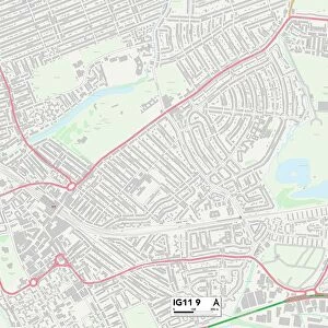
Barking and Dagenham IG11 9 Map

![]()
Wall Art and Photo Gifts from Map Marketing
Barking and Dagenham IG11 9 Map
Postcode Sector Map of Barking and Dagenham IG11 9
Media ID 19973256
Abinger Close Barking And Dagenham Bevan Avenue Blake Avenue Bridgeway Broadhurst Avenue Buller Road Cavendish Gardens Cecil Avenue College Way Cornwall Close Cranleigh Gardens Dawson Avenue Dereham Road Digby Road Lambourne Road Lansbury Avenue Longbridge Road Lyndhurst Gardens Malvern Drive Manor Road Meadow Close Meadow Road Merton Road Mulberry Court Oakley Avenue Payne Close Priory Road Ridley Close Rosslyn Road Salisbury Avenue Sandhurst Drive Sandringham Road Sheringham Drive Shirley Gardens Somerby Road Stratford Close Stuart Road Sudbury Road The Drive Thornhill Gardens Thorpe Road Tudor Road Waterside Close Woodbridge Road
FEATURES IN THESE COLLECTIONS
> Animals
> Birds
> Passerines
> Larks
> Related Images
> Europe
> United Kingdom
> England
> Cornwall
> Related Images
> Europe
> United Kingdom
> England
> Cornwall
> Stratton
> Europe
> United Kingdom
> England
> London
> Boroughs
> Merton
> Europe
> United Kingdom
> England
> London
> Politics
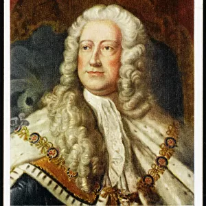
> John Stuart
> Europe
> United Kingdom
> Scotland
> Dumfries and Galloway
> Thornhill
> Map Marketing
> Postcode Sector Maps
> IG - Ilford
> Maps and Charts
> Related Images
MADE IN THE USA
Safe Shipping with 30 Day Money Back Guarantee
FREE PERSONALISATION*
We are proud to offer a range of customisation features including Personalised Captions, Color Filters and Picture Zoom Tools
SECURE PAYMENTS
We happily accept a wide range of payment options so you can pay for the things you need in the way that is most convenient for you
* Options may vary by product and licensing agreement. Zoomed Pictures can be adjusted in the Cart.