Home > Europe > United Kingdom > Scotland > Related Images
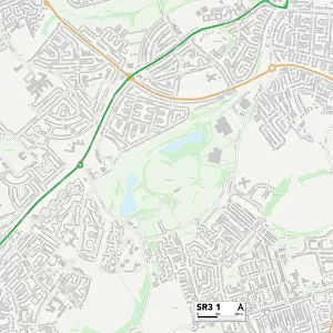
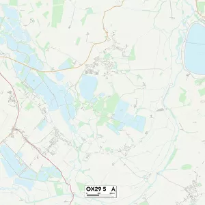
Cherwell OX15 5 Map

![]()
Wall Art and Photo Gifts from Map Marketing
Cherwell OX15 5 Map
Postcode Sector Map of Cherwell OX15 5
Media ID 19977247
Back Lane Bakers Lane Barley Close Beggars Lane Bell Hill Bells Lane Bourne Lane Brewery Lane Bridge Hill Brookside Broughton Butchers Lane Castle Hill Chapel Mews Chapel Street Cherwell Cotswold Close Cow Lane Crofts Lane Danvers Road East End Friars Lane Grange Lane Green Lane Heath Court High Lane High Meadow High Street Highlands Hill Lane Holloway Lane Hollybush Road Lower Green Main Road Main Street Middle Hill Millers Way Orchard Close Orchard Road Park Close Park Hill Park Lane Park Road Pinfold Close Pound Lane Queen Street Rectory Lane Rectory Road School Lane Station Road Sutton Lane Sycamore Close The Bourne The Glebe The Grange The Green The Park The Sidings The Square Walford Road Watery Lane Well Bank Brick Row Ironstone Rope Way Small House
FEATURES IN THESE COLLECTIONS
> Animals
> Mammals
> Muridae
> Heath Mouse
> Europe
> United Kingdom
> England
> London
> Sights
> Golders Hill Park
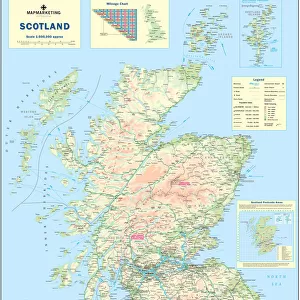
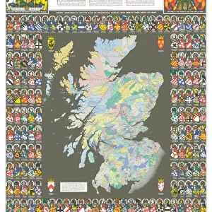
> Europe
> United Kingdom
> Scotland
> Castles
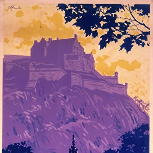
> Europe
> United Kingdom
> Scotland
> Highlands
> Related Images
> Europe
> United Kingdom
> Scotland
> Maps
> Europe
> United Kingdom
> Scotland
> Posters
> Europe
> United Kingdom
> Scotland
> Related Images
> Europe
> United Kingdom
> Wales
> Flintshire
> Broughton
> Map Marketing
> Postcode Sector Maps
> OX - Oxford
> Maps and Charts
> Related Images
MADE IN THE USA
Safe Shipping with 30 Day Money Back Guarantee
FREE PERSONALISATION*
We are proud to offer a range of customisation features including Personalised Captions, Color Filters and Picture Zoom Tools
SECURE PAYMENTS
We happily accept a wide range of payment options so you can pay for the things you need in the way that is most convenient for you
* Options may vary by product and licensing agreement. Zoomed Pictures can be adjusted in the Cart.