Home > Historic > Ancient civilizations > Ancient Greece > Greek history
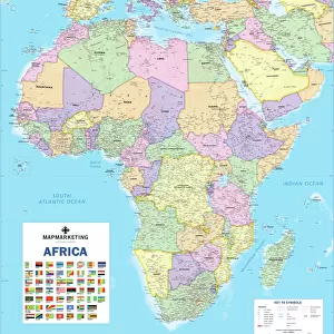
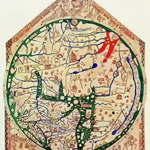
A Map Of Africa As Depicted During The 8Th Century Bc. From In Darkest Africa By Henry M. Stanley Published 1890

![]()
Wall Art and Photo Gifts from Design Pics
A Map Of Africa As Depicted During The 8Th Century Bc. From In Darkest Africa By Henry M. Stanley Published 1890
Design Pics offers Distinctively Different Imagery representing over 1,500 contributors
Media ID 18196457
© Ken Welsh / Design Pics
Africa African Ancient Chart Eighth Geography Greek Mapmaking
FEATURES IN THESE COLLECTIONS
> Africa
> Related Images
> Europe
> Greece
> Related Images
> Historic
> Ancient civilizations
> Ancient Greece
> Greek history
> Maps and Charts
> Early Maps
> Maps and Charts
> Related Images
EDITORS COMMENTS
This print showcases a remarkable piece of history - "A Map Of Africa As Depicted During The 8th Century BC". Taken from the renowned book "In Darkest Africa" by Henry M. Stanley and published in 1890, this map takes us back to ancient times when cartography was still in its early stages. The intricate details on this map provide a fascinating glimpse into how the African continent was perceived during the eighth century BC. It reveals the geographical features, rivers, mountains, and coastlines that shaped Africa's landscape at that time. This depiction is particularly intriguing as it reflects the knowledge and understanding of Greek explorers who ventured into these uncharted territories. Ken Welsh's skillful photography captures every nuance of this historical artifact with precision and clarity. The vibrant colors bring life to an otherwise faded document, allowing us to appreciate its significance even more. As we delve deeper into this image, we are transported back thousands of years ago when ancient civilizations thrived across Africa. It serves as a reminder of our shared human heritage and sparks curiosity about the cultures that once flourished within these borders. Whether you're a history enthusiast or simply intrigued by maps and geography, this print offers an extraordinary opportunity to explore Africa through the lens of an ancient era.
MADE IN THE USA
Safe Shipping with 30 Day Money Back Guarantee
FREE PERSONALISATION*
We are proud to offer a range of customisation features including Personalised Captions, Color Filters and Picture Zoom Tools
SECURE PAYMENTS
We happily accept a wide range of payment options so you can pay for the things you need in the way that is most convenient for you
* Options may vary by product and licensing agreement. Zoomed Pictures can be adjusted in the Cart.