Home > Arts > Artists > S > Robert Falcon Scott
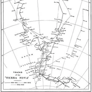
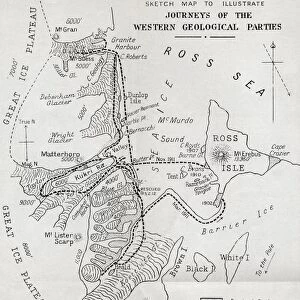
Map Showing The Tracks Of Robert Falcon Scotts Terra Nova Expedition 1910 To 1913. From South With Scott By Rear Admiral E. R. G. R. Evans

![]()
Wall Art and Photo Gifts from Design Pics
Map Showing The Tracks Of Robert Falcon Scotts Terra Nova Expedition 1910 To 1913. From South With Scott By Rear Admiral E. R. G. R. Evans
Map Showing The Tracks Of Robert Falcon Scotts Terra Nova Expedition 1910 To 1913. From South With Scott By Rear Admiral E.R.G.R. Evans
Design Pics offers Distinctively Different Imagery representing over 1,500 contributors
Media ID 18192798
© Ken Welsh / Design Pics
Antarctic Chart Expedition Exploration Falcon Geography Mapmaking Nova Pole Scott South Terra Tracks
FEATURES IN THESE COLLECTIONS
> Arts
> Artists
> S
> Robert Falcon Scott
> Maps and Charts
> Related Images
> Popular Themes
> Antarctic Expedition
EDITORS COMMENTS
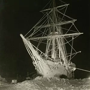
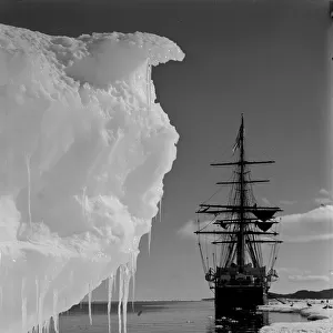
This print showcases a historical map titled "Map Showing The Tracks Of Robert Falcon Scotts Terra Nova Expedition 1910 To 1913". Taken from the renowned book "From South With Scott" by Rear Admiral E. R. G. R. Evans, this map takes us on an extraordinary journey through the British Antarctic and the quest for reaching the South Pole. The intricate chart beautifully illustrates the tracks of Captain Robert Falcon Scott's iconic expedition, which took place between 1910 and 1913. It serves as a testament to human determination and exploration in one of Earth's most unforgiving environments. Every line etched onto this map represents countless hours of meticulous mapmaking, highlighting the immense geographical challenges faced by these brave explorers. As we gaze upon it, we are transported back in time to witness their arduous trek across treacherous terrains and icy landscapes. Through this photo print, Ken Welsh captures not only a piece of history but also our fascination with adventure and discovery. It reminds us of humanity's unyielding spirit to push boundaries and explore unknown frontiers. Whether you are an avid explorer or simply intrigued by tales of bravery, this print is sure to captivate your imagination. Allow yourself to be immersed in the epic journey undertaken by Captain Scott and his team as they ventured towards their ultimate goal - conquering the South Pole.
MADE IN THE USA
Safe Shipping with 30 Day Money Back Guarantee
FREE PERSONALISATION*
We are proud to offer a range of customisation features including Personalised Captions, Color Filters and Picture Zoom Tools
SECURE PAYMENTS
We happily accept a wide range of payment options so you can pay for the things you need in the way that is most convenient for you
* Options may vary by product and licensing agreement. Zoomed Pictures can be adjusted in the Cart.