Home > Europe > United Kingdom > England > London > Boroughs > Bromley
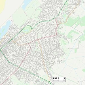
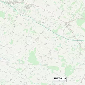
Ashford TN26 2 Map

![]()
Wall Art and Photo Gifts from Map Marketing
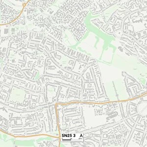
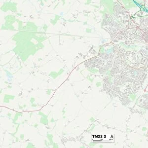
Ashford TN26 2 Map
Postcode Sector Map of Ashford TN26 2
Media ID 19982492
Ashford Ashford Road Bank Side Bourne Lane Capel Road Church Lane Church Road Cock Lane Donkey Lane Dukes Meadow Fairfield Terrace Farm Road Gill Lane Heathside Lancaster Close Malthouse Lane Military Road Moor Lane Oak Ridge Old Way Parker Close Romney Road School Road St Marys Close Tenterden Road The Street Village Way Willow Drive Woodchurch Road Appledore Hawthorn Hop Garden
FEATURES IN THESE COLLECTIONS
> Animals
> Birds
> Passerines
> Crows And Jays
> Green Magpie
> Animals
> Farm
> Donkeys
> Related Images
> Animals
> Mammals
> Muridae
> Heath Mouse
> Europe
> United Kingdom
> England
> London
> Boroughs
> Bromley
> Map Marketing
> Postcode Sector Maps
> TN - Tunbridge Wells
> Map Marketing
> UK Maps
> Maps and Charts
> Related Images
> North America
> United States of America
> New York
> New York
> Sights
> Wall Street
MADE IN THE USA
Safe Shipping with 30 Day Money Back Guarantee
FREE PERSONALISATION*
We are proud to offer a range of customisation features including Personalised Captions, Color Filters and Picture Zoom Tools
SECURE PAYMENTS
We happily accept a wide range of payment options so you can pay for the things you need in the way that is most convenient for you
* Options may vary by product and licensing agreement. Zoomed Pictures can be adjusted in the Cart.