Home > Europe > United Kingdom > England > London > Boroughs > Croydon
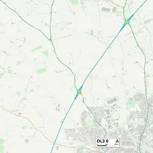
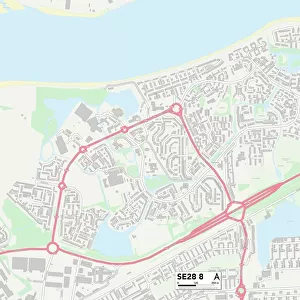
Croydon SE25 6 Map

![]()
Wall Art and Photo Gifts from Map Marketing
Croydon SE25 6 Map
Postcode Sector Map of Croydon SE25 6
Media ID 19981814
Alexandra Place Bruce Road Burgoyne Road Charnwood Road Clifton Road Cranleigh Gardens Croydon Dagmar Road Dixon Road Dunkeld Road Egerton Road Elm Park Road Ely Road Farnley Road Grange Avenue Grange Gardens Grange Hill Holmesdale Road Huntly Road Newhaven Road Oban Road Park Road Parry Road Peace Close Pembroke Road Prince Road Reservoir Close Ross Road Rothesay Road St Dunstans Road St Marys Road Suffolk Road Talbot Road The Retreat Thirsk Road Walters Road Wharncliffe Road Whitworth Road
FEATURES IN THESE COLLECTIONS
> Europe
> United Kingdom
> England
> London
> Boroughs
> Croydon
> Europe
> United Kingdom
> England
> Suffolk
> Related Images
> Europe
> United Kingdom
> Scotland
> Aberdeenshire
> Huntly
> Europe
> United Kingdom
> Scotland
> Fife
> Falkland
> Europe
> United Kingdom
> Scotland
> Strathclyde
> Oban
> Europe
> United Kingdom
> Scotland
> Strathclyde
> Rothesay
> Europe
> United Kingdom
> Wales
> Pembrokeshire
> Pembroke
> Map Marketing
> Postcode Sector Maps
> SE - London SE
> Maps and Charts
> Related Images
MADE IN THE USA
Safe Shipping with 30 Day Money Back Guarantee
FREE PERSONALISATION*
We are proud to offer a range of customisation features including Personalised Captions, Color Filters and Picture Zoom Tools
SECURE PAYMENTS
We happily accept a wide range of payment options so you can pay for the things you need in the way that is most convenient for you
* Options may vary by product and licensing agreement. Zoomed Pictures can be adjusted in the Cart.