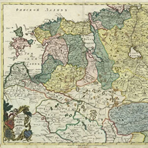
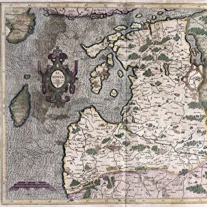
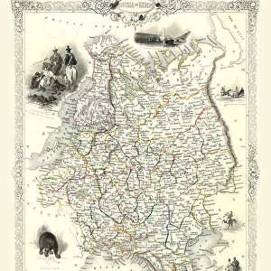
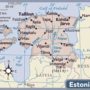
Map Ducatuum Livoniae et Curlandiae novissima tabula
Map, Ducatuum Livoniae et Curlandiae novissima tabula in quibus sunt Estonia Litlandia et aliae minores provinciae per Justum Danckerts Amstelodami, Justus Danckerts (1635-1701), Copperplate print
Liszt Collection of nineteenth-century engravings and images to browse and enjoy
MADE IN THE USA Safe Shipping with 30 Day Money Back Guarantee
FREE PERSONALISATION* We are proud to offer a range of customisation features including Personalised Captions, Color Filters and Picture Zoom Tools
SECURE PAYMENTS We happily accept a wide range of payment options so you can pay for the things you need in the way that is most convenient for you
* Options may vary by product and licensing agreement. Zoomed Pictures can be adjusted in the Cart.
redeem
Beautiful Photo Prints and Gifts
image
Professionally Printed
inventory
Photo Prints are in stock
thumb_up
Professional quality finish
diamond
Made with high-grade materials
inventory_2
Carefully packed to aid safe arrival
Related Images
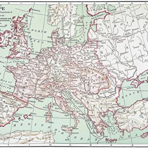
MAP OF EUROPE, c1812. A 19th century German map of Europe during the reign of Napoleon I
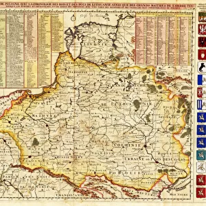
Map of Poland includes portions of Livonia and Grand Duchy of Moscow par Chatelain, Henri Abraham (1684-1743). Etching, watercolour, 1714, Private Collection
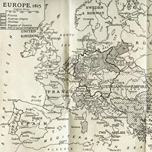
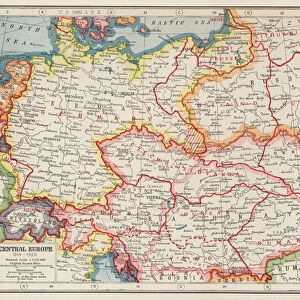
Map of Europe according to the Peace Treaties 1918 - 1924. From The Evolution of Modern Europe, 1453 - 1932, published 1933
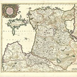
Map of Estonia and Livonia - Anonymous master - 1745 - Copper engraving, watercolour - Academy of Sciences, Saint Petersburg
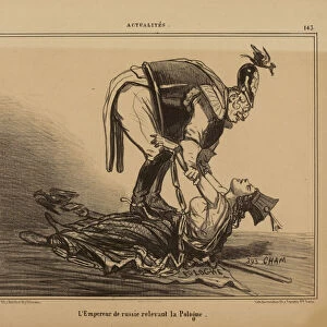
The Emperor of Russia relieving Poland, 1855. Creator: Cham (Amedé